by Dr Alec Bennett PhD MInstP FRMetS CMet
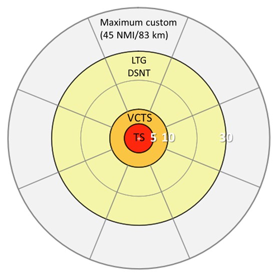
Thunderstorms are reported in US Federal Aviation standards according to the location of lightning. For automatic reports, the distances are in nautical miles. Thunderstorms producing lightning within 5 nautical miles (9 km) of the site are considered overhead, with the METAR code TS. Thunderstorms between 5-10 nautical miles (9-19 km) are defined as being in the vicinity (VCTS). For these two classifications, only the proximity is important, with no requirement to report direction. For lightning detected between 10-30 nautical miles (19-56 km), referred to as distant lightning (LTG DSNT), a direction is required, although only as to which octant (N, NE, etc.) or octants were affected.
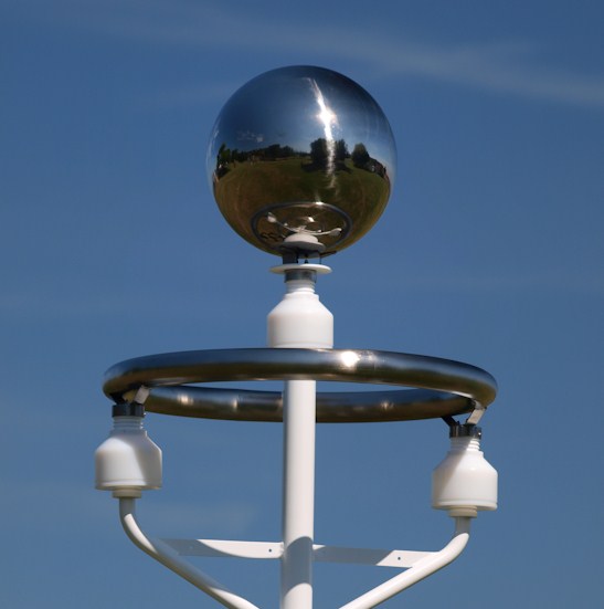
There is no FAA requirement to report lightning at distances greater than this 30 nautical mile (56 km) limit, although detection of lightning at greater distances provides advance warning that a thunderstorm might be heading towards the aerodrome. With this in mind, the BTD-300 can be customised to provide an alert of lightning detected up to 45 nautical miles (83 km) away.

In addition to thunderstorm reporting, the BTD-300 detects the presence of electrically charged precipitation and strong electric fields. Both of these features indicate the presence of a Cumulonimbus (CB) overhead, providing an early warning of potential nearby lightning activity and aiding the reporting of this significant cloud type. Whilst not all Cumulonimbi produce lightning, they are associated with an increased risk to aircraft from severe turbulence, icing, hail, wind shear, and induced lightning strikes.

The BTD-300 is designed to operate under the intense electrostatic fields beneath thunderstorms and is virtually immune to all forms of man-made radio-frequency interference, making it an ideal choice for high radio emission environments such as airports. All types of lightning are detected and ranged (cloud-to-ground, intra-cloud, cloud-to-cloud, etc.) with >95% detection efficiency and <2% false alarm rate, providing a reliable and accurate assessment of total lightning activity. The system is particularly sensitive to weak intra-cloud flashes, which can signal the onset of thunderstorm activity before the first cloud-to-ground flash. Thunderstorm reporting sectors surrounding an aerodrome according to the US Federal Aviation Administration (FAA). Such sectors are reported by an automated weather observing system (AWOS). Red is thunderstorm overhead (TS), orange is thunderstorm in the vicinity (VCTS), and yellow is distant lightning (LTG DSNT), the latter including the appropriate octant(s).
About the Author: Dr Bennett is the Meteorological Products Manager for Senseca UK, UK. He has a PhD in Atmospheric Electricity and 10 years of experience in the research and development of lightning detection systems, including working at the UK Meteorological Office and being a visiting Research Fellow at the University of Bath. He has written over 20 papers on atmospheric electricity, which have been published in peer-reviewed international journals.